
original document:
NOV 2000
reconditioned:
AUG 2019

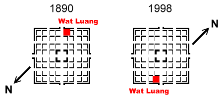
Please note: Modern maps are orientated approximately to the North. Therefore they all are turned about 180° in comparison to the old map of 1890. That pertains to all now following maps. In consequence our new town map from 1998 has been turned at 180° in comparison to the old map of 1890.

The official map of 1982, scale 1:100000 shows the shape of the old town not clearly enough. But on a satellite image of 1988 the squares and the walls can be seen excellently.
The following map is a detail of the map F-47-107 (B.MUANGSING). The grid covers of 2 km.
The map does not show the square shape of the old town clearly enough.
The square old town Müang Sing can be seen quite clearly in the centre of the picture.
The satellite image was made especially for the demands of forestry (Swedforest Scandia Consult). The green vegetation is a dark contrast to the light colours of dry ricefields. There are trees and bushes on the wall, especially in the north, so that the wall is accentuated.
The French fort replaced the southern corner of the wall. - The old streets are visible.
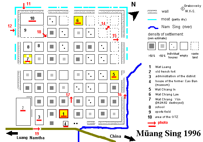
During our survey in Müang Sing we closely inspected the remains of the town wall and the town moat as well as the area inside. In short the following observations seem worth mentioning [1996/1998 !!]:


... [1996 bzw. 1998] with a click at each red marked point in the town map

